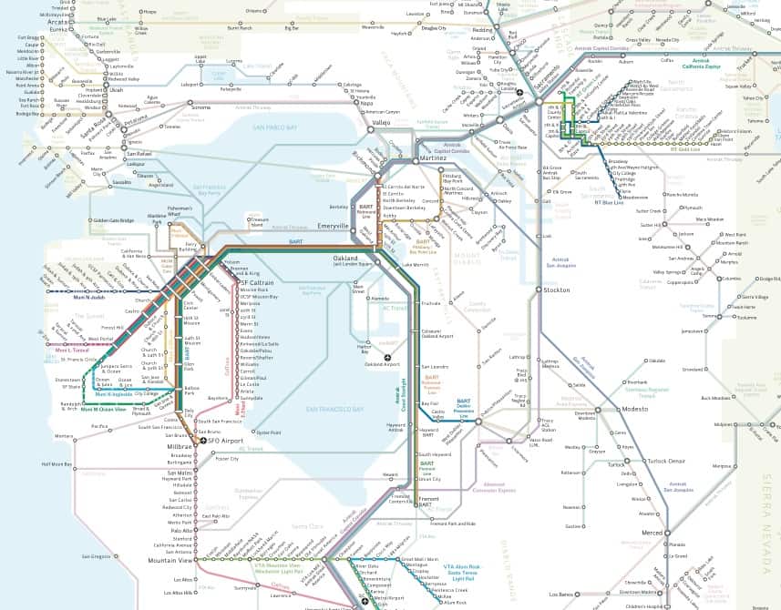
Bay Area rail lines– more extensive than you thought, huh? Screen grab via: California Rail Map
It’s not hard to access a map of California’s highway system– from google maps to regional maps, highways are visible and this comes as no surprise. What is surprising however, is that it is only now has someone compiled a map of California’s extensive (and growing) rail system.
The team at California Rail Map has put together a map of California featuring: Amtrak, BART, Muni, VTA, Caltrain, Altamont Commuter Express, Sacramento Regional Transit, NCTD, San Diego Trolley, LA Metro, and Metrolink (in addition to key bus and ferry connections between rail services).
The end result – a rather impressive map – highlights many possible ways to explore California’s gold, car-free!
For more information, head over to California Rail Map’s website. And rail enthusiasts who just can’t get enough, make sure to check California Rail Map out on facebook for more impressive maps, infographics, and conversation about high-speed rail.
Oh yeah, and don’t forget to download your own California Rail Map.