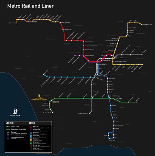
A map of Los Angeles’ current rail network. Image credit: Kriston Lewis
Los Angeles is being hailed for its steady revival of the thriving rail system it once had, but the current plan to create a convenient network that connects the whole county is still 30 years away. The Los Angeles rail system has seen rapid growth in usage with the most recent addition, the Expo Line, which was completed earlier this year.
Now, let’s imagine what the freeway system in L.A. would like like if it was a rail system? We have an idea thanks to “Stonebrown Design,” who has put together maps of L.A.’s freeway system as though it were a rail system:
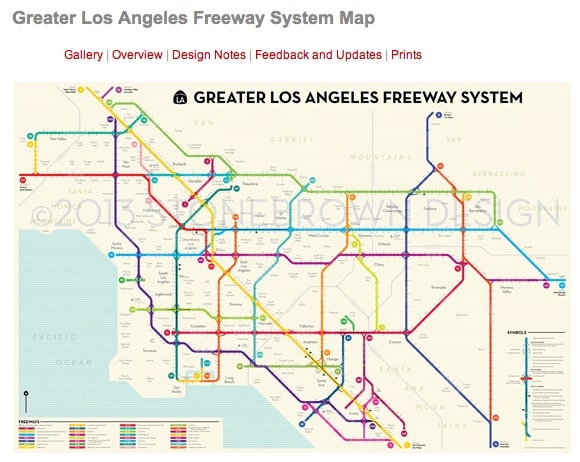
Los Angeles’ freeway system, seen in rail map form. Screen-grab via: Stonebrown Design
Comparing the above Stonebrown Design map to the current Metro Rail map there is a clear visualization demonstrating that rail doesn’t serve as many people as the freeways do (yet!).
To see more detailed maps of L.A.’s freeways with a “public transit vision,” head over Stonebrown Design’s Greater Los Angeles Freeway System Map page (soon you’ll be able to purchase prints as well, due to a rather successful Kickstarter campaign).