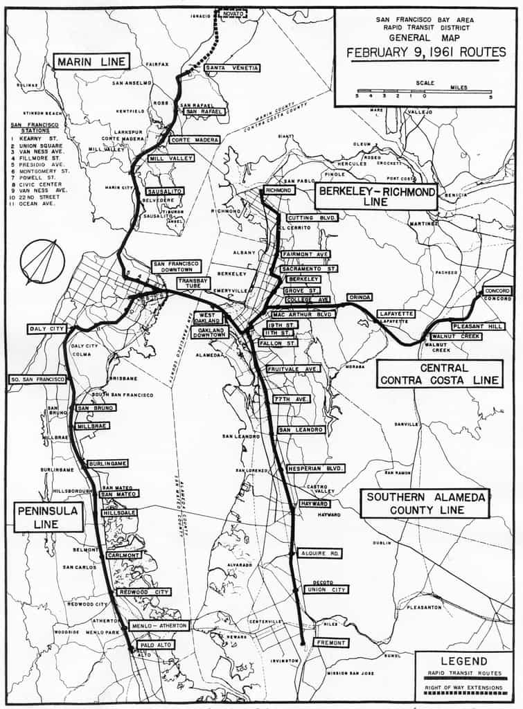
Recently, we stumbled upon a 50-year old map of the BART system from 1961, more than a decade before it began operation. Remarkably, the map is very similar to the system that was eventually built and is running today, but without the extensions to Palo Alto and Novato:
[Photo via Eric Fischer]
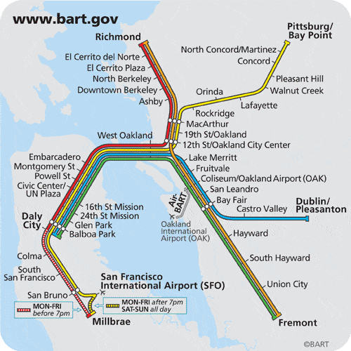
For comparison, here is the current BART system map as of March 25, 2010:
[Photo via BART.gov]
To see the original old BART map and others, visit the San Francisco Public Library History Room (6th floor) vertical files, “SF Transportation / Rapid Transit / BART / Maps” or view Eric Fischer’s photos on Flickr.
For more information, visit BART.gov or read about BART on Wikipedia.


