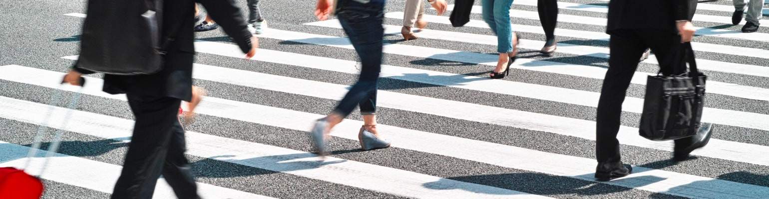
Walking to work, school, or shopping is a pollution-free way to get around. It’s also an easy way to add exercise to your daily routine.
- Get Rewarded
- Regional Trails
- Multi-Use Trail Rules
- Winter Walk Challenge
- Transit to Trails: Take Transit to Great Walks and Hikes
- Bike/Pedestrian Paths: Bay Bridge & Richmond-San Rafael Bridge
- Caltrans Report: Walking on the Rise
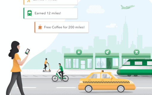
Get Rewarded
The $25 Drive Less Commuter Incentive is available to qualified commuters who make the switch from driving alone to walking, biking, riding the bus, taking BART or commuting by train.
Regional Trails
The Contra Costa County Interpark Regional Trails consist of more than 150 miles of paved trails that connect various Regional Parks. These linking trails cut through cities and along major streams and channels providing car-free routes for pedestrians and cyclists.
Explore other trail options, including the San Francisco Bay Trail, East Bay Bicycle Loop Trails, and East Bay Short Loop Trails.
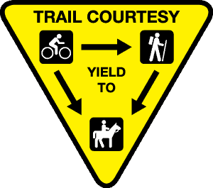
Multi-Use Trail Rules
Safe use of multiple-use trails requires everyone’s cooperation and common courtesy.
- Bicycles yield to horses and pedestrians
- Pedestrians yield to horses
- Passing: Slow down, ring bell or call out before the pass
- Stay to the right except when passing
- No motorized vehicles are permitted on the trail, wheelchairs excepted
Winter Walk Challenge
Every winter, 511 Contra Costa provides free, healthy, outdoor fun with the Winter Walk Challenge. People throughout Contra Costa can explore their towns on foot, getting exercise and entering to win free stuff in the process. Participants receive weekly emails with walking-oriented challenges to complete, so if you’re looking for family-friendly winter fun, join us for the Winter Walk Challenge.
Transit to Trails: Take Transit to Great Walks & Hikes
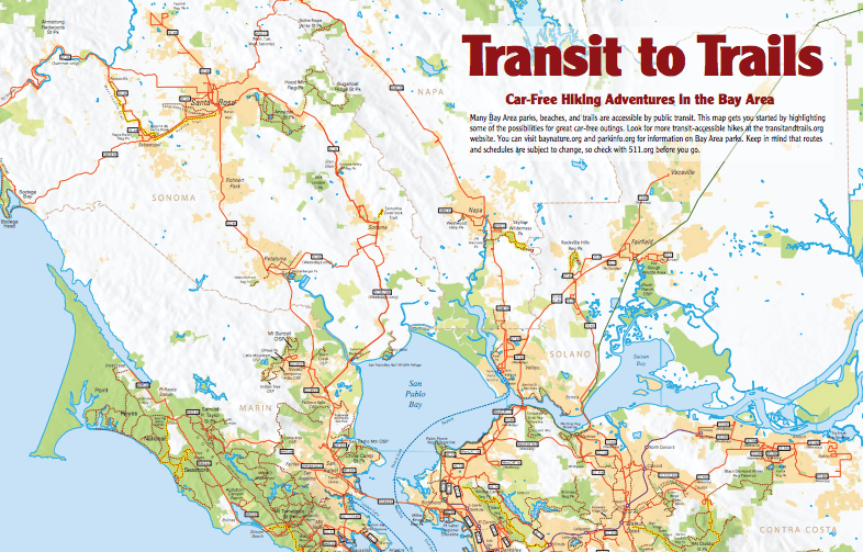
Many Bay Area parks, beaches, and trails are accessible by public transit. This map gets you started by highlighting some of the possibilities for great car-free outings. You can visit baynature.org and parkinfo.org for information on Bay Area parks. Keep in mind that routes and schedules are subject to change, so check with 511.org before you go.
Bay Bridge and Richmond-San Rafael Bridge Bike/Pedestrian Paths
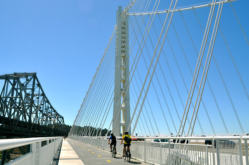
The East Bay span of the Bay Bridge features a bicycle and pedestrian path from Oakland to Treasure Island, providing fantastic views of the Bay and beyond. Get details about path access from the Bay Bridge website.
The Richmond-San Rafael bike and pedestrian path runs along the north side of Interstate 580 from Castro Street in Richmond across the upper deck of the bridge to East Francisco Blvd. in San Rafael. Cyclists and pedestrians can travel the 10-foot wide, bi-directional path on the bridge’s upper deck separated from vehicle traffic.
Caltrans Report: Walking, Biking, Transit on the Rise
Caltrans released the results of its latest California Household Travel Survey (CHTS) in March 2014. The survey is conducted every ten year and looks at how Californians travel. According to the most recent survey, the percentage of California residents walking, biking, or using public transportation had more than doubled since 2000; the three modes increased in mode-share, collectively, from 11 percent to 23 percent.
Caltrans Director Malcolm Dougherty noted, “Based on this research, we can make good decisions about transportation that will improve mobility, air quality, and travel choices for all Californians and make our state a better place to live and work.”
The table below from the latest CHTS shows the exact breakdown of travel mode distribution, and how it compares to the 2000 survey:
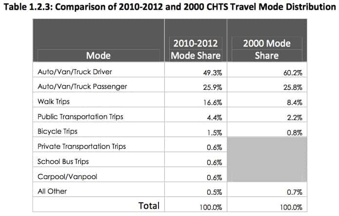
Single-occupancy cars remain the most prevalent travel mode. However, it now makes up less than half of all trips, having plummeted from 60% to 49% of trips.
Interestingly, despite frequently hearing about today’s public transit and bicycling booms, the fastest growing travel mode in the Golden State over the last decade was walking, which more than doubled from 8% of trips to 17% trips.
The results from the survey mark a dramatic shift in the state’s travel patterns and show no signs of reversing. Looking at the numbers one can’t help but to wonder– what will the next California Household Travel Survey look like?