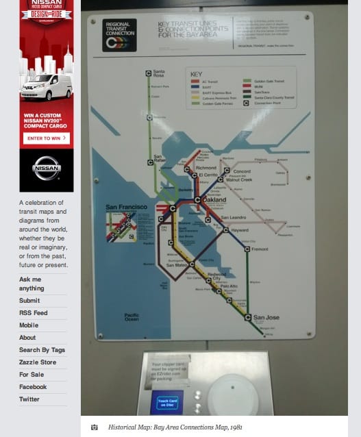
Transit connection map from 1981, still in use after more than 30 years. Screen grab via: TransitMaps
The Transit Maps tumblr recently highlighted the above photo taken by transit rider Alex Jonlin of 1981 transit map he spotted in the Fremont BART Station. Jonlin, comments on the map:
I saw this at the Fremont BART Station a couple weeks ago. It’s labeled (in tiny print at the top) “September 1981.” I have no idea how it ended up staying for so long, but it’s interesting to see how the transit system has changed since then. I also like the concept of depicting long-distance rail and long-distance buses just about the same – it shows people that the Bay Area’s transit network extends beyond where just the BART and Caltrain go.
Now whether the fact that the map is still in use several decades since it was made is a good thing or a bad thing you can decide for yourself. The style of the map remains rather stylish but if you need a transit map that’s a little more current, feel free to check out our Contra Costa Transit Map page.